Every small town has a story. We've mapped991of them.

Loading trip map…

Scenic Byways

Kananaskis Country:
Highway 40 South

A slow weekend drive through Canada’s quietest Rockies, ending at the highest paved road in the country.

Kananaskis is what people mean when they say they want Banff without the crowds.

Highway 40 leaves the Trans-Canada near Seebe, drops south into the Kananaskis River valley, and climbs steadily for 67 kilometres before topping out at Highwood Pass — at 2,206 metres, the highest paved road in Canada. Same Rockies, half the parking lots.

Albertans treat Kananaskis as their not-Banff and quietly hope the rest of you stay away. The drive is the spine, but the whitewater on the Kananaskis River, the ski hill from the 1988 Olympics, the Nordic spa, and the alpine meadows above the treeline are why you don’t just drive it in a morning.

Plan two days. Stay at the Village. Pack a picnic for both lunches — there’s only one real restaurant south of the Village, and there’s nothing at all south of Boundary Ranch.

Day 1 — Calgary to Kananaskis Village

→ 90 km 

🚗 About 85 km, 1 hour west of Calgary on Hwy 1, then south on Hwy 40

Scenic Drive · Outdoor

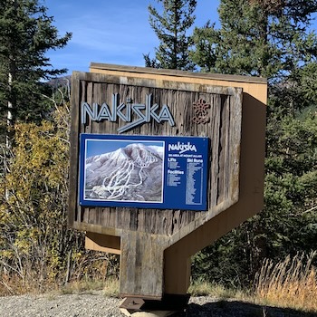
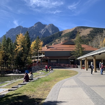
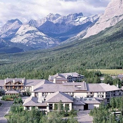
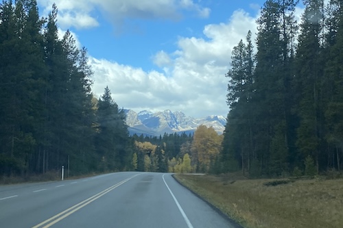
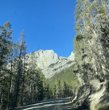
Kananaskis Country (Highway 40 entry)

★ 5.0 Hwy 1 / Hwy 40 junction, Kananaskis Village, AB

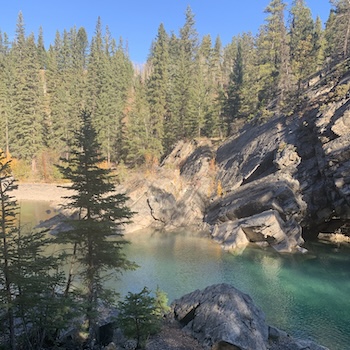
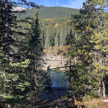
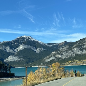
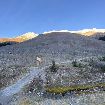
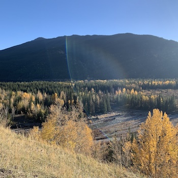
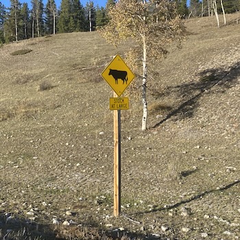
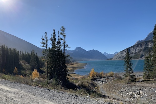
This is where you leave the Trans-Canada and the crowds. Highway 40 drops south off Hwy 1 at the Seebe interchange and climbs steadily through 67 kilometres of mountain valley before topping out at Highwood Pass. Stop at the entry kiosk to buy a Kananaskis Conservation Pass — required for parking anywhere in K-Country.

🚗 5 km · 5 minutes south of the Hwy 40 entry

River · Outdoor · Photo Spot

Canoe Meadows

★ 5.0 Canoe Meadows, Kananaskis, AB

A wide riverside day-use area where whitewater kayakers and rafters launch into the Kananaskis River. Even if you’re not paddling, the rapids are loud and the put-in is the show. The river is dam-controlled, so flow times are predictable — releases usually run late morning to mid-afternoon in summer.

🚗 1 km · 2 minutes south of Canoe Meadows

River · Outdoor · Photo Spot

Widowmaker

★ 5.0 Widowmaker, Kananaskis, AB

Same Kananaskis River, more serious water. The name describes the rapid, and the Hollywood crews who’ve filmed here weren’t kidding. Watch from the bank as paddlers come down through the boulder garden. The eddy below makes it easy to catch them mid-line. Quieter than Canoe Meadows; better for photography.

Explore more →
Widowmaker Day Use Area • Kananaskis Visitor Information Centre Riverside trail downstream — 5–10 minute walk along the bank to watch from different angles

🚗 4 km · 5 minutes south of Widowmaker

Outdoor · Viewpoint · Hike

Barrier Lake

★ 5.0 Prairie View Trail Parking

A reservoir lake, but you’d never guess it from the trail. The 7-km loop around the lake stays low and forested with frequent water views; Mount Baldy dominates the south end. The Barrier Lake Visitor Centre on the highway is your last reliable bathroom and information stop before things get rural.

🚗 1.2 km · 3 minutes 
History

The Colonel’s Cabin

★ 5.0 The Colonel’s Cabin, Alberta 40

A 1934 forestry station cabin repurposed in 1939 to hold German prisoners of war during the Second World War. Quiet, small, and rarely visited. Worth the detour if Canadian wartime history matters to your trip; skip it if you’re racing south to Highwood Pass.

🚗 8.8 km · 8 minutes from the Colonel’s Cabin
Hike · Outdoor

Wasootch Ridge Trailhead

★ 5.0 Wasootch Creek, Kananaskis

Trailhead for a 13.4-km out-and-back ridge hike with one of the longest sustained ridge walks in Kananaskis. Steep at the start, then easy walking along the spine for kilometres. April through October. Bring poles and water — there’s no shade above the treeline.

🚗 3 km · 4 minutes south of Wasootch
Birding · Picnic · Outdoor

Mount Lorette Ponds

★ 5.0 Mount Lorette Ponds, Kananaskis

Three small engineered ponds at a bend in the Kananaskis River. Stocked with trout for casual anglers and a known birding stop — Canada geese, ospreys, and golden eagles all pass through during spring and fall migration. A flat, wheelchair-accessible loop makes it the easiest stop on the drive. Have your lunch here - the ponds have shaded picnic tables, a flat accessible loop, the river running past, and mountains on every side.

Explore more →
Mount Lorette Ponds Day Use — accessible loop trail and picnic facilities Fishing — rainbow trout stocking — licence required; check current rules
🚗 3.3 km · 5 minutes from Mount Lorette Ponds
Stay · Family

Sundance By Basecamp

★ 5.0 2 Sundance Rd #40, Kananaskis

Glamping in canvas trapper tents and tipis along the Kananaskis River. Closed in winter. A family-friendly base if you don’t want a hotel and don’t want to pitch your own tent. Tents come with beds and woodstoves; tipis sleep larger groups. An alternative overnight to the Village hotels — book months ahead.

Explore more →
Sundance by Basecamp (official site) — booking, season dates, what’s includedd parking Canvas trapper tents — woodstove and double beds inside Riverside fire pits — the part everyone remembers
🚗 3.7 km · 5 minutes from Sundance By Basecamp
Hike · Waterfall · Family

Troll Falls

★ 5.0 Troll Falls, Kananaskis

An easy 3.4-km family trail through aspen forest to a tiered waterfall. The path is gentle enough for strollers up to the lower viewing platform; the upper falls require a short scramble. Look for the troll faces in the rock — that’s the joke that gives the falls their name.

Explore more →
Troll Falls trail (AllTrails) — easy 3.4 km out-and-back Hay Meadow loop extension — add the meadow trail for a longer 6 km loop Upper Troll Falls scramble — short rocky climb above the main falls — be careful in wet weather
On the way to Troll Falls
Birding · Wildlife · Outdoor

Golden Eagle Migration Observation Site

★ 5.0 Hay Meadow, Kananaskis Village

Each March and again in October, thousands of golden eagles funnel through the Kananaskis Valley between northern Canada and the southwestern United States. The Rocky Mountain Eagle Research Foundation runs Eagle Watch here on peak days. Bring binoculars. Most visitors don’t know this migration happens.

Explore more →
Rocky Mountain Eagle Research Foundation (Eagle Watch) — daily migration counts during peak weeks Hay Meadow interpretive area — viewing benches with binocular mounts
🚗 1.5 km · 2 minutes from Troll Falls parking
Ski · Outdoor

Nakiska Ski Area

★ 5.0 2 Mt Allan Dr, Kananaskis

Built for the 1988 Calgary Winter Olympics and still running as a friendly mid-size ski hill. Sixty-four runs across all levels, less crowded and cheaper than Banff. Off-season the chairlift runs for sightseers and the trails open for hikers. Closest skiing to Calgary.

🚗 5 km · 8 minutes back south to the Village turnoff, then up Mount Kidd Drive
Outdoor · Stay

Kananaskis Village

★ 5.0 Kananaskis Village, AB

A purpose-built resort village wrapped around two hotels: the Pomeroy Kananaskis Mountain Lodge and the smaller Mount Kidd Manor. Hosted the G8 summit in 2002 and the G7 in 2025. Not a town in the traditional sense — more like a basecamp with parking, restaurants, and walking access to everything you came south for.

Explore more →
Village shops and Black Tie Café — coffee, pastries, and small retail around the village square G7 Summit 2025 history — why Pomeroy was off-limits in June 2025
🚗 Walking distance from the Village (or 1 km drive)
Spa · Stay

Kananaskis Nordic Spa

★ 5.0 1 Centennial Dr, Kananaskis Village

Hot pools, cold plunges, eucalyptus steam saunas, hammocks, and outdoor exfoliation cabins, all looking up at Mount Kidd. The three-cycle hydrotherapy routine is the point: hot, cold, rest. Book a four-hour pass minimum and bring two swimsuits — staying wet in winter is colder than you’d think.

🚗 Inside Kananaskis Village
Outfitter · Outdoor

Kananaskis Outfitters

★ 5.0 1-279 Mt Sparrowhawk Crescent, Kananaskis

Built for the 1988 Calgary Winter Olympics and still running as a friendly mid-size ski hill. Sixty-four runs across all levels, less crowded and cheaper than Banff. Off-season the chairlift runs for sightseers and the trails open for hikers. Closest skiing to Calgary.

Explore more →
🚗 Walking distance inside the Village
🍷 Dinner

Cedar Room · Pomeroy Kananaskis Mountain Lodge

★ 5.0 1 Centennial Dr, Kananaskis Village

Gastropub menu with mountain views — the easy 8 p.m. reservation. For something fancier, book Forte in the same hotel. Woody’s Pub is the casual third option if you just want a beer and a burger. All three are inside the Pomeroy Kananaskis Mountain Lodge.

🚗 Walking distance inside the Village
Overnight

Pomeroy Kananaskis Mountain Lodge

★ 5.0 Mountain Lodge ★ 5.0 · 1

The main hotel in the Village — full service, indoor pool, shuttle to the Nordic Spa across the road. Mount Kidd Manor next door is cheaper and smaller. Sundance by Basecamp (Stop 10, glamping on the river) is the alternative if you booked tents. All three book months ahead for summer weekends.

Day 2 — Village to Highwood Pass and home

→ ~210 km

🚗 In the hotel — no drive
Breakfest

Forte Restaurant · Pomeroy Kananaskis Mountain Lodge

★ 5.0 1 Centennial Dr, Kananaskis Village

Full sit-down breakfast at the Pomeroy. Black Tie Café in the Village square is the quick coffee-and-pastry alternative if you’re moving early. Pack a sandwich to go — Day 2 lunch will be a picnic and there’s nothing south of the Village.

🚗 6 km · 7 minutes south from Pomeroy Kananaskis Mountain Lodge
Family · Outdoor · Food

Boundary Ranch

★ 5.0 2 Guinn’s Road, Box 44, Kananaskis

A working guest ranch offering trail rides for all levels — kids from six up. The shorter rides loop through aspen meadows; the longer ones climb into the foothills. BBQ dinners, staged gunfights, and wagon rides round it out. Touristy in the cheerful sense — great for families with younger kids.

🚗 2 km · 3 minutes south on Lorette Rd to the Kananaskis Country Golf Course
Food · Viewpoint

Summit Restaurant

★ 5.0 1 Lorette Rd, Kananaskis

The restaurant at the Kananaskis Country Golf Course terrace looks straight at Mount Kidd and Mount Lorette. You don’t need to be a golfer — the terrace is open to walk-in lunch. Skip the meal here if you’re still full from breakfast, but at least pull in for the view.

Explore more →
🚗 4 km · 5 minutes south from the Kananaskis Country Golf Course
Family · Outdoor · Picnic

Wedge Pond

★ 5.0 Wedge Pond, Kananaskis

A small pond rather than a lake, with a flat 1.6-km loop trail and a gravel beach for kids to splash. Not for swimming laps — for spreading a blanket while small humans throw rocks at the water. The mountain backdrop is the same as the Village but the crowds are half.

🚗 27 km · 30 minutes south, then west on Kananaskis Lakes Trail (10 km) into Peter Lougheed PP
Outdoor · Viewpoint · Hike

Lower Kananaskis Lake

★ 5.0 Lower Kananaskis Lake, Kananaskis

The largest lake in Peter Lougheed Provincial Park and the centre of K-Country’s south end. Boardwalks, fishing piers, trails fanning out from three day-use areas, and Interlakes Campground if you want to stay overnight. The shore loop is mostly flat with the Opal Range as a constant backdrop.

🚗 You’re at Lower Kananaskis Lake — no extra drive
🥪 Lunch

Picnic at Boulton Bridge boardwalk

★ 5.0 Boulton Bridge, Peter Lougheed PP, AB

The restaurant at the Kananaskis Country Golf Course terrace looks straight at Mount Kidd and Mount Lorette. You don’t need to be a golfer — the terrace is open to walk-in lunch. Skip the meal here if you’re still full from breakfast, but at least pull in for the view.

🚗 22 km · 25 minutes back east to Hwy 40, then south to Elbow Pass Day Use
Hike · Alpine · Outdoor

Elbow Pass (Elbow Lake trailhead)

★ 5.0 Elbow Pass, Kananaskis

A short but steep 1.3-km hike — 125 metres of climbing — reaches Elbow Lake and a backcountry campground. The lake sits on the literal divide between two watersheds, fed by the Rae Glacier melting above. Bring a windbreaker; the pass is exposed.

Explore more →
🚗 3 km · 4 minutes south of the Elbow Pass turnoff
Alpine · Outdoor · Wildlife

Rock Glacier

★ 5.0 Rock Glacier, Kananaskis

A 15-minute interpretive walk across an active rock glacier — a slow river of moving stone above 2,000 metres. Look for pikas in the boulders; they barely move 10 metres from their rock pile in a lifetime. This is the threshold of true alpine, where arctic-Canadian plants grow in southern Alberta.

🚗 3 km · 3 minutes south of Rock Glacier — the high point of the drive
Viewpoint · Alpine · Scenic Drive

Highwood Pass

★ 5.0 Hwy 40, Kananaskis, AB

At 2,206 metres, the highest paved road pass in Canada. A short interpretive trail crosses the pass itself, and the Ptarmigan Cirque trail starts across the road. Closed to vehicles December 1 to June 15 each year for wildlife. Cell signal disappears. Weather changes in minutes. Layer up.

🚗 10 km · 10 minutes south of Highwood Pass — past the Alberta/BC divide
Viewpoint · Photo Spot

Mount Armstrong Viewpoint

★ 5.0 Mount Armstrong, East Kootenay, BC

A named peak rising on the BC side of the divide, visible from a pull-off on the south flank of Highwood Pass. The mountain is shadowed at dawn and lit in the afternoon — plan your photo stop for the way back north, not the way down.

🚗 ~30 km · 30 minutes — continue south on Hwy 40 to Highwood Junction, then 5 km east on Hwy 541. Only on the loop-back route.
Wildlife · Outdoor · Family

Sentinel Day Use (Mountain Cows)

★ 5.0 Sentinel Day Use Park, AB-541, Kananaskis Improvement District

Yes, cattle — grazing on Crown land along Hwy 40’s southern stretch and into Hwy 541. The southern foothills of K-Country were assigned multi-use status in 1978, which is why you’ll see cows, oil-well sites, and hiking trails sharing the landscape. Stop at Sentinel for the picnic tables and to remind yourself this isn’t a national park. Skip this stop if you’re returning north via Hwy 40 — it’s 30 km past Highwood Pass and only practical on the Hwy 541 / Cowboy Trail loop.

Good to know

Best time

Mid-June to October for the full route. The Highwood Pass section of Hwy 40 closes to vehicles December 1 to June 15 for wildlife. The northern half — Hwy 1 to the Kananaskis Lakes Trail turnoff — stays open year-round. Late September brings golden larches; July and August bring wildflowers above the treeline.

Where to stay

Pomeroy Kananaskis Mountain Lodge or the smaller Mount Kidd Manor — both at the Village. Sundance by Basecamp on the river for glamping in canvas tents and tipis. Mount Kidd RV Park for full-service camping. Boulton Creek Campground in Peter Lougheed PP if you want to wake up closer to the alpine.

Total driving

~170 km out-and-back along Hwy 40, plus ~20 km of side trips into Peter Lougheed PP and Highwood Pass viewpoints — call it ~210 km total. From Calgary and back, budget ~370 km over two days, or ~420 km on the Cowboy Trail loop.

Fuel & food

Fill up in Canmore or at the Husky station at the Hwy 1 / Hwy 40 junction. Sit-down restaurants only at Kananaskis Village (Cedar & Stone, Forte, Woody’s Pub, Brewster’s Kitchen at the Pomeroy) and Summit Restaurant at the golf course. Boulton Trading Post in Peter Lougheed PP has basic groceries May–September. No food or fuel south of Boundary Ranch — pack a picnic and a full tank for the Peter Lougheed / Highwood Pass stretch.

More guides from this region

Scenic Byways

Bow Valley Parkway: Banff to Lake Louise

1 day · 100 km

See the guide  →

Municipalities & Tourism Organizations

Is your community along this route?

We feature small towns in our trip guides — with Google Ads, newsletters, and placement seen by thousands.

Who Are You?

Any changes to the place info will be reviewed by 1000 Towns of Canada.